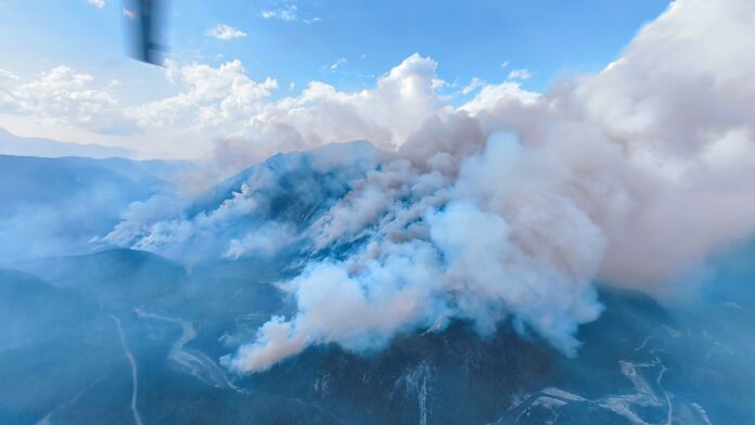
All evacuation alerts for the Ravenshead fire have been rescinded as the fire is now being held.
“We want to acknowledge the incredible work by the crews which, in combination with improved fire conditions, have resulted in the BC Wildfire Service making the recommendation to us to rescind the Alert,” said RDEK Information Officer Loree Duczek.
The area restriction will stay in place for the time being.
“The fire remains active and the work by firefighters and the support crews will continue. In addition, the Area Restriction remains in effect and there is no public access within the restricted area at this time.”
Crews have made good progress on all of our local fires, with no more blazes out of control.
“Although we have seen some rain over the past few weeks, we are still seeing some new starts. We need the public to remain diligent and abide by the full fire ban which includes no campfires, no fireworks and no open burning of any kind in the East Kootenay,” added Duczek.
Out of Control wildfires:
None at this time.
Wildfires being held:
Mount Morro – N21014 – Located in Top of the World Provincial Park (currently closed)
- Size – 11,903 hectares
- Suspected cause – lightning
- Discovered on July 17, 2024
More: BC Wildfire Service shrinks restricted area around two local wildfires (Aug 7, 2024)
Lost Dog – N21284
- Size – 899.4 hectares
- Suspected cause – Lightning
- Discovered on July 20, 2024.
- An area restriction has been put in place.
MORE: Area restriction in effect for Lost Dog area (July 29, 2024)
Ravenshead – N21610
- Size – 8,615 hectares
- Suspected cause – Under investigation
- Discovered on July 24, 2024
- All evacuation alerts have been rescinded.
- The area restriction was reduced along the south side of the fire.
More: BC Wildfire Service shrinks restricted area around two local wildfires (Aug 7, 2024)
Bradford Creek – N11212
- Size – 41 hectares
- Suspected cause – Lightning
- Discovered on July 19, 2024
Wildfires under control:
Dogtooth FSR – N21427
- Size – 5,680 hectares
- Suspected cause – Lightning
- Discovered on July 22, 2024.
- No longer a wildfire of note.
- The Town of Golden confirmed that 15 structures including four homes were destroyed.
- An evacuation order remains in place for 4490 Thomas Road, 2104 Highway 95 South and all properties on Rauch Road.
- The evacuation alert for 339 properties from Hawkins Road to approximately two kilometres south of Parson is still in effect.
- An area restriction is in place.
More: Evacuation alert partially rescinded for Dogtooth blaze (Aug 7, 2024)
Cedared Creek – N22298
- Size – 0.009 hectares
- Suspected cause – Lightning
- Discovered on Aug. 20, 2024
Leach Creek – N12216
- Size – 0.009 hectares
- Suspected cause – Human
- Discovered on Aug. 14.
For more information on specific wildfires in the region contact the Southeast Fire Centre at [email protected] or 250-318-7715.
More Information
The BC Wildfire Service is the primary source of information for all wildfire activity.
Regional District East Kootenay (RDEK) is the primary source of information for evacuation orders and evacuation alerts.
Drive BC for all information on roads and road closures.
Be the first to know! Don’t miss out on breaking news and daily updates in your area. Sign up to MyEastKootenayNow News Alerts.


