Living Lakes Canada (LLC) said a recent study of 10 local shorelines shows gradual degradation of local ecosystems.
This comes as LLC completed a four-year lake study to understand how lake foreshores in the Columbia Basin are changing because of urbanization and development.
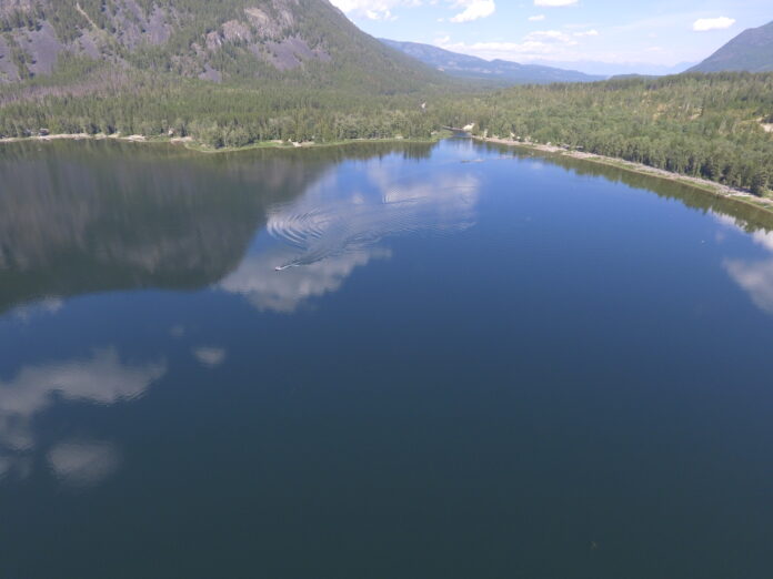
A foreshore is a strip of land that lies between a lake’s high and low watermarks which LLC officials said is an important area for cultural, economic, and ecological value.
The study found consistent issues across the various lakes caused by human involvement.
“Development pressures are continuing to degrade shoreline habitats across the Columbia Basin,” said Georgia Peck, LLC Lake Program Manager.
“We are seeing a similar rate of change in development and urbanization regardless of the lake’s jurisdiction.”
The lake survey used a method called Foreshore Integrated Management Planning (FIMP) and targeted Columbia Basin lakes with aquatic at-risk species.
Those species included Kootenay River White Sturgeon, Shorthead and Columbia Sculpin and Westslope Cutthroat Trout.
“Freshwater biodiversity is declining rapidly on a global scale, and lake foreshores can provide habitat to roughly 90% of all lake biodiversity. Understanding the health of a lake’s foreshore and the rate of impacts is key to sustainable lake management,” said Peck.
“The FIMP work undertaken by Living Lakes Canada in the Columbia Basin is a testament to the value and effectiveness of FIMP as a powerful yet practical cumulative-impact assessment tool for freshwater conservation.”
The study focused on Kootenay, Slocan, Arrow and Trout lakes in the West Kootenay, and Whitetail, Whiteswan, Moyie, Windermere, Columbia, and St. Mary lakes in the East Kootenay.
LLC said FIMP studies are important for understanding shoreline conditions and tracking their change over time.
This is done by a team on a boat, using GPS and drone assessments to observe land use, shore type and foreshore condition.
Peck said the ongoing degradation highlights a need for improved conservation.
“Current management practices are not mitigating development as well as they can be,” said Peck. “If we don’t take a collective effort, we’re going to continue seeing declines in natural shorelines.”
Other findings and recommendations can be found here.