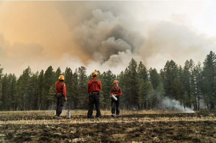
The evacuation order issued in response to the Madias Creek was downgraded to an alert as crews make progress in pushing back the flames.
“With the great work that the RDEK Firefighters and BC Wildfire Crews have been putting in, the order that was in place has been able to be downgraded to an alert,” said Loree Duczek Regional Emergency Operations Centre Information Officer.
“Residents that are in the alert area should stay prepared and be ready to leave on a moment’s notice should conditions change and an order needs to be re-issued.”
The evacuation order included 27 properties in the Crooked Tree/Madias Creek area that were tactically evacuated on Monday.
The alerts put in place by the RDEK and ʔakisq̓nuk First Nation Council are still in place.
The two-hectare fire is believed to be human-caused and remains out of control.
Out of Control wildfires:
Island Pond – N21295
- Size – 37 hectares down from an original estimate of 120.
- Suspected Cause – lightning
- Discovered on July 20, 2024
- Heavy equipment has been assigned to the fire along with 25 firefighters.
- Air tankers have completed their objectives, but will be available if they are needed again.
- No significant growth was recorded since and machine guard around the fire perimeter has been established.
- Crews have completed structure protection work on areas of concern.
- Drivers on Highway 93/95 are asked not to slow down or stop along the highway as it is causing an unsafe situation for both the public and responders.
- The two evacuation orders and 65 evacuation alerts are still in place.
MORE: Evacuation order issued due to Island Pond fire (July 20, 2024)
Mount Morro – N21014 – Located in Top of the World Provincial Park (currently closed)
- Size – 3,700 hectares
- Suspected cause – lightning
- Discovered on July 17, 2024
- This fire originated at high elevation on Mount Morro, in extremely steep terrain that is inaccessible to crews.
- This fire is classified as a modified response. Wildfire Officers and an initial attack crew have worked with BC Parks to protect park values.
- BC Wildfire officials said the fire has grown significantly since it was discovered but remains within the park’s boundaries.
Madias Creek – N21398
- Size – 2.1 hectares
- Suspected cause – Human
- Discovered on July 22, 2024
Bradford Creek – N11212
- Size – 29.3 hectares
- Suspected cause – Lightning
- Discovered on July 19, 2024
Lost Dog N- N21255
- Size – 3 hectares
- Suspected cause – Lightning
- Discovered on July 19, 2024
Mount McMillan – N21284
- Size – 2 hectares
- Suspected cause – Lightning
- Discovered on July 20, 2024.
Alkaline Lake – N11500
- Size – 0.009 hectares
- Suspected cause – Lightning
- Discovered on July 23, 2024
Wildfire being held:
Gold Creek 1 – N11234
- Size – 3.3 hectares
- Suspected cause – Lightning
- Discovered on July 19, 2024
Brewer Ridge – N21207
- Size – 0.2 hectares
- Suspected cause – Lightning
- Discovered on July 19, 2024
Wildfires under control:
Ta Ta Creek – N11416
- Size – 0.009 hectares
- Suspected Cause – Lightning
- Discovered on July 22, 2024
For more information on specific wildfires in the region contact the Southeast Fire Centre at [email protected] or 250-318-7715.
Be the first to know! Don’t miss out on breaking news and daily updates in your area. Sign up to MyEastKootenayNow News Alerts.


