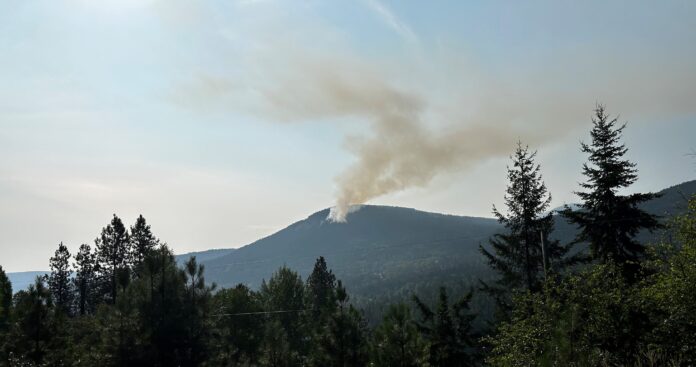
After seeing some lightning roll through our region this afternoon, we have seen some new fires on the BC Wildfire Map.
Here is the most up to date information on the current fires, a BC Parks closure, and some relevant health information.
NEW STARTS
Brewer Ridge (N21207) – Southwest of Windermere Lake
Size – 0.009 ha
Suspected cause – Lightning
Bradford Creek (N11212) – West of the Skookumchuck area near McNair Lakes
Size – 0.3 ha
Suspected cause – Lightning
Lost Dog Main (N11219) – West of the Skookumchuck area near McNair Lakes
Size – 0.009 ha
Suspected cause – Lightning
Mather Creek (N11225) – West of Lost Dog Lake
Size – 0.1 ha
Suspected cause – Lightning
Gold Creek (N11235) – West of Twin Lake
Size – 0.01 ha
Suspected cause – Lightning
Tee Pee Creek (N11234) – West of Twin Lake
Size – 0.3 ha
Suspected cause – Lightning
Updated
Mount Morro (N21014) – Located in Top of the World Provincial Park
Size – 1,293 ha
Suspected cause – Lightning
*BC Parks Closure
Due to the Mount Morro Wildfire (N21014), BC Parks has closed Top of the World Provincial Park.
On a positive note, Michel Creek (N11063 – Southeast of Sparwood) is now being classed as Under Control.
For more information on specific wildfires in the region contact the Southeast Fire Centre at [email protected] or 250-318-7715.
Be the first to know! Don’t miss out on breaking news and daily updates in your area. Sign up to MyEastKootenayNow News Alerts.


